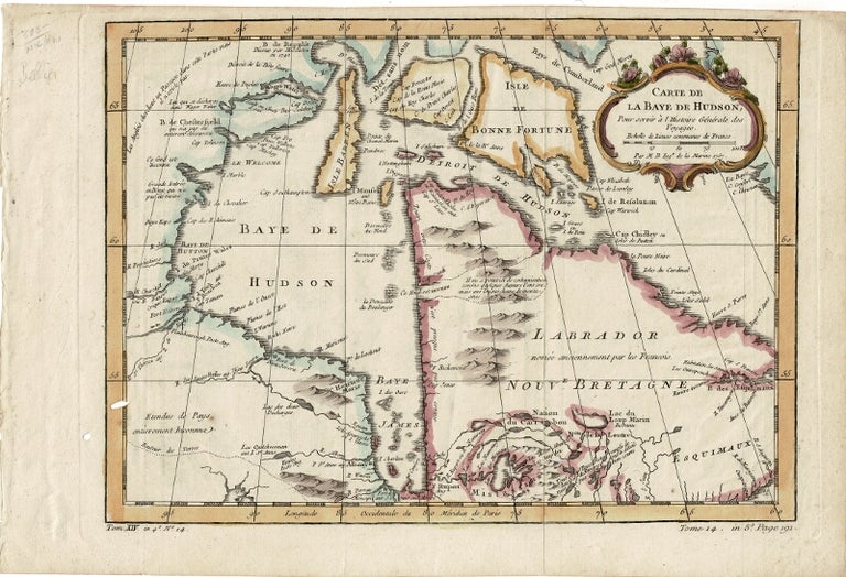
Carte de la baye de Hudson, pour servir à l'histoire générale des voyages...Par M.B., Ingr. de la Marine
[Paris]: 1757. Copper-engraved, hand-colored map, decorative cartouche, sheet size 250 x 369 mm., plate size 212 x 302 mm.; 2 small holes, one of which affects plate, edges a bit toned, shallow tears along left-hand edge not affecting plate, previous folds; a very nice copy. "Tom. XIV, in 4to, No. 14" and "Tome 14, in 8vo, page 191" printed at the bottom. Bellin was appointed the first Ingénieur de la Marine of the Dépot des cartes et plans de la Marine in 1741, and named the Official Hydrographer to the King, Louis XV. He is best known not only for his productive output (his maps cover the French territories of North America, from Canada to Louisiana), but also his accuracy. Item #39338
Price: $250.00