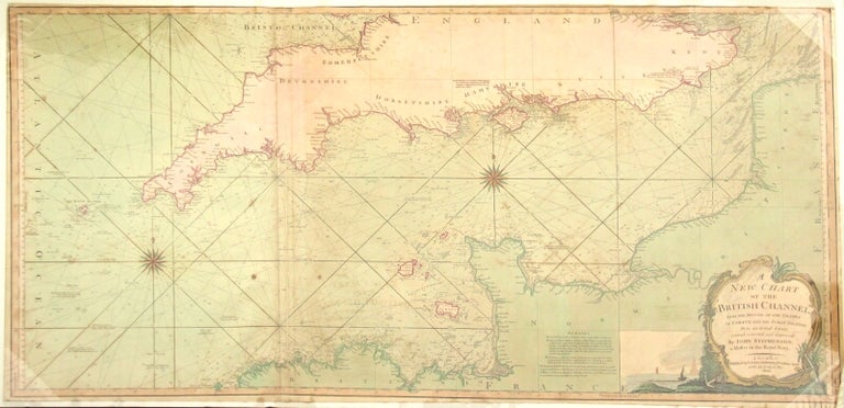
A new chart of the British Channel, from the mouth of the Thames to Ushant, and the Scilly Islands; from an actual survey revised, corrected, and improved by John Stephenson, a Master of the Royal Navy
London: Laurie & Whittle, 1800. One large hand-colored folding map (525 x 1151 mm); small tear at right-hand bottom corner, else a fine, attractively colored map. Item #39585
Price: $1,250.00
See all items in
Cartography
See all items by John Stephenson