![Item #42993 Standard map of Chisago County, Minnesota, showing selected roads in red [cover title]](https://rulon.cdn.bibliopolis.com/pictures/42993_2.jpg?width=768&height=1000&fit=bounds&auto=webp&v=1631202439)
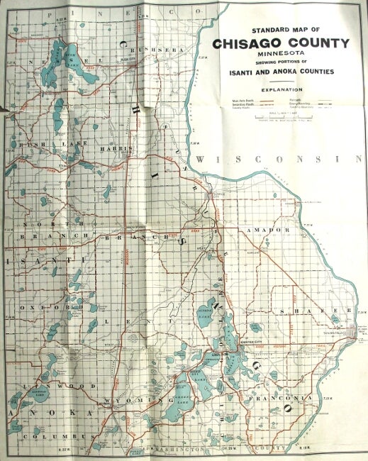
Standard map of Chisago County, Minnesota, showing selected roads in red [cover title]
St. Paul: McGill-Warner Co., 1920. One color map (approx. 648 x 521 mm.) folded down to approx. 178 x 114 mm. in brown printed wrappers; occasional tears from folds, else very good. Map title: "Standard map of Chisago County, Minnesota, showing portions of Isanti and Anoka Counties". University of Minnesota and Minnesota Historical Society only in OCLC. Item #42993
Price: $175.00