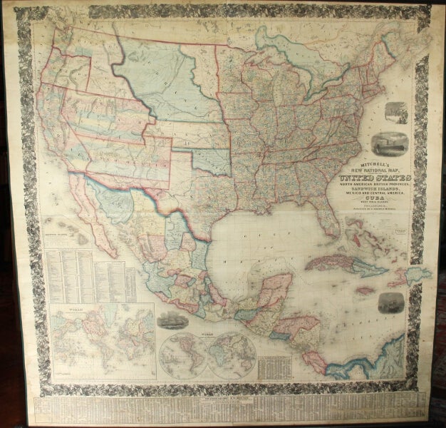
Mitchell's new national map, exhibiting the United States, with the North American British Provinces, Sandwich Islands, Mexico, and Central America. Together with Cuba and the West India Islands
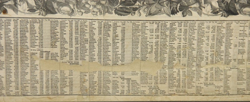
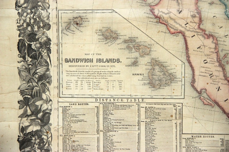
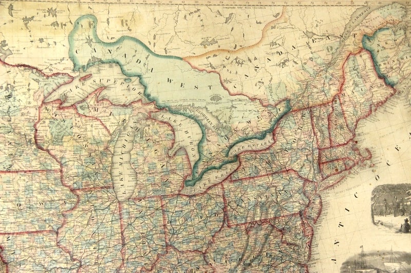
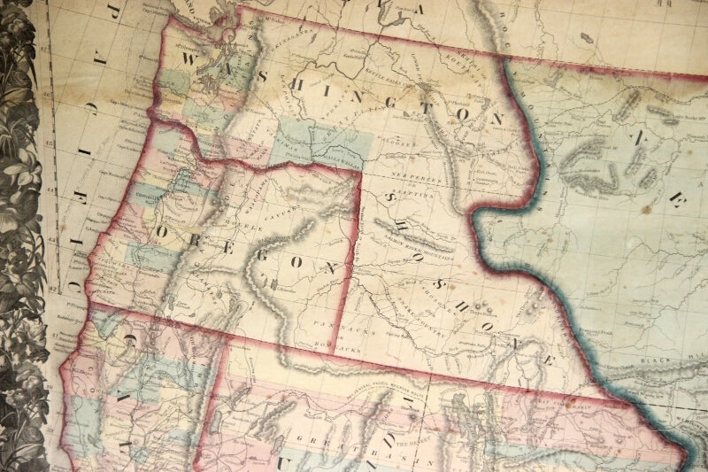
Philadelphia: S. Augustus Mitchell, 1859. Large hand-colored wall map on rods, approx. 64" square, with 4 engraved vignettes, 3 inset maps (2 of the world, and 1 of the Sandwich Islands), all within an elaborate floral border; some infill along the margins, slight loss in the population tables at the bottom, and several cracks in the paper, the whole neatly and professionally backed with linen; overall appearance is certainly very good or better, with the usual small defects. America as it was on the eve of the Civil War. Unusual features of this map include the Shoshone Territory (what is now mostly Idaho), Colona (now part of Colorado), the unusually large Nebraska, the horizontal Utah and New Mexico, and the unusually small Dakotas. Phillips, Maps of America, lists only the 1856 edition. OCLC records examples from 1856, 1857 (both on conjoined sheets), 1858, 1860 and 1861, but not this. Item #49436
Price: $7,500.00