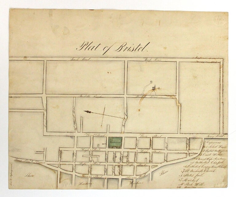
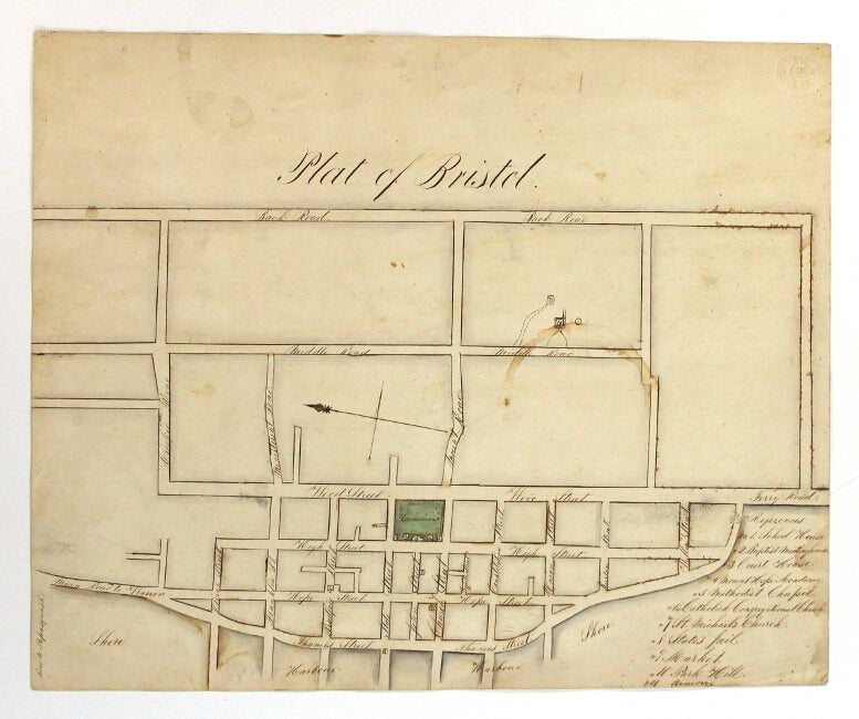
Plat of Bristol
[Bristol?]: n.d., [ca. early 1800s]. Manuscript plat map of the town of Bristol (approx. 12¼" x 14¾") accomplished in sepia ink and green wash, showing downtown Bristol from the harbor east to Thames, Hope, High, and Wood Sts. to the "Back Road" (now Metacom Ave.), north to the "Road to Poppasquash," and south from Oliver, Franklin, Bradford, State, John, Church, Constitution, Union, Burton, and Walley Sts. to Ferry Road. The town commons central in green, and with keyed numbers to 11 buildings, including the school house, the Baptist Meeting House, and the Court House on the commons, and also the Methodist Chapel, the Congregational Church, St. Michael's Church, the town jail, and the armory. Small cup stain on a mostly blank portion, otherwise very good. Item #56268
Price: $1,500.00