Geographical, statistical, and historical map of Porto Rico and the Virgin Islands
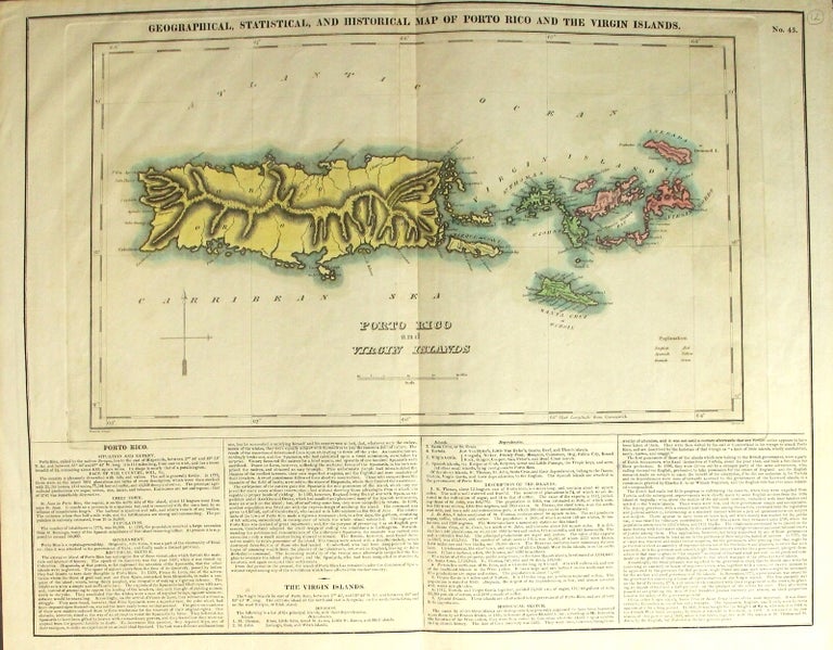
Philadelphia: Carey & Lea, after 1822. Hand-colored engraved map approx. 17½" x 22½" overall, the engraving itself approx. 11½" x 18½", with 4 columns of text beneath; central fold; very good. Extracted from a later edition of Carey & Lea's American Atlas. English (red), Danish (green), and Spanish (yellow) possessions indicated by color. Item #59143
Price: $450.00